Saturday, December 10, 2022

So, We Paid This Diver $20……..

 The Gulf of Mexico.  Yes!

A major milestone on our Great Loop adventure.  A place of respite after two months of shallow rivers and crowded locks and rafts of barges the size of battleships.  Our plan was to spend November dawdling along the Gulf Coast before making our “crossing “ to winter moorage in Florida.  

And God said, “HA!


We had scheduled an underwater inspection  (along with some other maintenance) for Panama City later in November.  But while we were relaxing at Orange Beach Marina in Orange Beach , AL, a neighboring Looper told us there was a diver on the dock offering to do inspections for $20.    After all the shallow, muddy water of the rivers, we were anxious to know the status of our props, zincs, and bottom paint.  We knew we had bumped the bottom or a piece of driftwood a time or two.  So, we slipped the guy a Jackson and down he went.

He came to the surface shortly to report that we had  damage to one propeller. And both shafts and  struts.  And that the nuts securing both props were loose!  (Thank heaven for those cotter pins!).  And our anti-fouling bottom paint was beginning to flake and fail.  And we have an 18 crack in the starboard side of our swim step hidden just below the rub rail. And there is some other damage to the fiberglass below the waterline.  His pictures told the sad story. 

Oh, shit (in spades!)

Loose prop nuts

Underwater fiberglass damage

More underwater fiberglass damage

Crack in swim step

Loose prop buts

Bent strut

port prop damage


To our endless good fortune, we were right next door to the Orange Beach boatyard of Saunders Yachtworks, one of the top-rated boatyard on the Gulf coast.  Within a few hours we had them engaged to haul the boat and help us assess the damage.   With the proviso that we would have to wait several days before that could work us into their haul out schedule and make space for Irish Lass in their yard.

So, the questions REALLY began to accumulate……

  1. How long to repair the port prop?  Is the starboard prop OK?
  2. Are the struts repairable or must they be replaced?  Is the latter, where are they available for a 20 year-old boat.
  3. Are the shafts bent or just temporarily bowed by the damaged struts?  If bent, can they be straightened or must they be replaced?  And if replaced, can new ones be located?
  4. Is the damage to the swim step cosmetic or structural?   Is it  repairable or do we need to replace it? 
  5. What is the extent of the bottom paint failure?
  6. How long to complete all this work?
  7. How much will it all cost? 
  8. How much, if any,  will insurance cover?
  9. When can we get back underway?
  10. And, last but certainly not least, how the heck  did all this happen?
The haul out was finally accomplished for November 15th .  Scott, the manager at Orange Beach Marina proved to be a godsend, extending our stay and offering wise counsel about repairs and the boat yard.  Obviously, our plans for a leisurely  November cruise east along the Gulf coast were now up in the sir. Certainly, Thanksgiving in Panama City was questionable.  We picked up a rental car at Hertz and moved ashore to a  pet-friendly Airbnb property a few minutes from the boatyard and began to work with the crew at Saunders to assess the damage.

Stay tuned, ya all……….

Thanks for following our journey

Be sure to track us on NEBO 

Monday, December 5, 2022

Top O' The World

 (And Goin’ Downhill Fast)

 We entered Pickwick Lake at our highest elevation (414 feet) since Lake Michigan.  And it certainly felt Like the top of the world.   Except for the homes on shoreline hills, there is nothing higher in view and the water looks wide open after weeks on the rivers.  (Although the architects can’t seem to decide if they are in Tennessee, or Tahoe or Tuscany.  Sheesh.)

But  looks can indeed be deceiving.   The lake is shallow and close attention must be paid to the depth sounder and the navigation aids.  (And the air is scented with the aroma of a nearby paper mill.  Heavy sigh.)  A south-easterly course will continue down the course  of the Tennessee River toward Chattanooga and points further east.  But a quick  turn to starboard (our choice) heads east toward the beginning of the Tennessee-Tombigbee Waterway, our eventual  route the Gulf od Mexico. 

Our stop here was at the Grand Harbor Resort and Marina.  A beautiful facility with a large marina (including 90’ lake houseboats!) and condo development, it also proved to be a bit deceiving.  The staff was limited, there was no onsite restaurant and the shore-side amenities reserved for condo owners.  Still, it had a steady flow of Loopers and our three days there included many reunions with friends.    

The highlight of this stop was a visit to the Shiloh National Military Park near Corinth, TN,  with Water Witch friends Jeff and Laurie   


The scene of three days of back-and-forth Civil War carnage, it now contains extensive historical displays, military monuments, and a National Cemetery the at is the final resting place for hundreds of veterans.  The battle here in April 1861 marked the ascendency of Ulysses S Grant and William Tecumseh Sherman as Union military leaders and the point at which the Union took the upper  hand over Confederate forces in what was then the West.  Casualties on both sides were staggering.  From here, Sherman began his March to the Sea.  And Grant was recalled east  to assume command of all Union forces.  The Museum and Visitor Center are first rate.  The battlefield is so extensive, and so exhaustively mapped and marked by the Park Service, one could spend several days  to cover it all (just as the soldiers did during the back-and-forth fighting).   Interestingly, there is little mention of the reason for the fighting.  Apparently the Park Service walks a fine line between commemorating a Union victory and appeasing the locals. 

Shiloh Chapel


Departing Grand Harbor, we headed south into the Tennessee-Tombigbee Waterway (aka: “The Tenn-Tom” or “The Ditch”).  This 444-mile made-made waterway roughly follows the course of the Tombigbee River (aka: “the most important river in America you have never heard of”) and provides a navigation channel from the Gulf of Mexico to the Ohio River that bypasses the problematic Mississippi.    Construction began in 1972 and involved the movement of more dirt and rock than either the Suez or Panama Canal.   The last phase of the project was completed in 1985.  Without it, the Great Loop as we know it would not exist (as the lower Mississippi is not particularly boater friendly. ) Along the Tenn-Tom, we passed thru eight locks, spent four nights at anchor, made four stops in marinas, and spent time in three states (TN, MS, and AL).  

At Midway Marina in Fulton, MS, we encountered  the absolute worst “courtesy” car on the entire Loop.  An extended-cab Ford F-150 with the back doors welded shut and a bed filled with a week’s worth of marina garbage.  Plus, an interior so toxic it nearly required Haz-Mat gear.  YUCK!

Midway Marina on the Tenn-Tom

At Columbus, MS we met an absolutely wonderful veterinary clinic that treated Admiral Maggie for a urinary tract infection .  The took us in on 2-hour notice and treated her like a queen.  A full health check, some lab work and an Rx for antibiotics and she is good as new.   

Veterinary ANGELS!

At a  dark, spooky  anchorage at McKinley Creek where we serenaded the wildlife with CCR’s “Born on the Bayou”.  And were in-turn serenaded by low passes from Air Force pilots-in-training from nearby Columbus AFB.

Anchored up the Bayou with CCR

White cliffs of Alabama

Middle of nowhere on the lower Tenn-Tom 

While Mobile on the Gulf of Mexico was our  ultimate destination on our river voyage, the first objective for us and many other Loopers was to reach the magical city of Demopolis, AL by the end of October.  Magical because it A) offers a good marina and B) lies just above 32 degrees north latitude, a line our insurance carriers require we remain north of until November 1st (the “official” end of hurricane season).    The marina was chock full of Loopers and even offered a potluck Halloween party.   But on the morning of the 1st, Look Out!  There was a near tidal wave of 16 Loopers exiting and heading downstream through the fog to the Demopolis Lock.   

Below Demopolis, we entered some of the most isolated waters on the Great Loop.   And the further south  we went, the spookier and swampier the terrain became. We’re takin’ banjo music country.    Our one marina (using the term broadly) was at a place called Bobby’s Fish Camp (yes, really).   A tired metal dock against a riverbank dotted with trailers and hunting  shacks, it was like moored inside an episode of Duck Dynasty ( minus the wealth).   

Bobby's Fish Camp

A Looper mainstay, however, as it is the only source of diesel fuel and shore power in the 216-mile trip from  Demopolis to Mobile.  With its famous restaurant permanently closed and its store reduced to “ice, beer and Coke”, we only stopped because of its Looper reputation.  But except for easy shore access for Admiral Maggie  and the social interaction with other Loopers, there was nothing to recommend it.

Fellow Loopers at our final anchorage

Sunset at Tensaw River anchorage

Good advice in gator country

On our last two days before Mobile, we began to spot gators (10+ footers!)sunning on the shore.  Our final  anchorage at Tensaw River, we were extra cautious in our shore visits for Admiral Maggie, carrying a boat hook, keeping her leashed, and keeping the outboard running.  In reality, the weather was cool,  and it is not breeding season, keeping the reptiles mostly in active.  But it is a bit disconcerting being “in the food chain”, so to speak.   Sheesh .

Tankers in Mobile Harbor

Back to salt water @ Mobile!

Passing thru Mobile put  us back in real civilization for the first time since Lake Michigan.  It is a busy commercial harbor with oil terminals and shipyards on both banks.   And exiting the river into Mobile Bay found us back at sea level and salt water.   An escort of dolphins welcomed us to the Gulf of Mexico!  

Mobile Bay welcoming committee


And, boy, are we glad to be done with rivers and locks  Whew!

Thanks for following our journey


Be sure to track us on NEBO

Thursday, November 24, 2022

O Brother Where Art Thou

Into the Land of the TVA


Up the Cumberland River!


"Way down yonder in the land of gravel....."


From Paducah, its a short run up the Ohio to the mouth of the Cumberland River, where we began the winding 31 mile climb up to the Barkley Dam.  (We were last in a line of seven Looper boats making that journey and the fought the cumulative affects of the their wakes in the narrow river channel the entire way.  Sheesh.)   At the dam, the lock lifted us all some 57 feet and allowed us to enter Barkley Lake at 358 feet above sea level. 

If we had proceeded across Barkely Lake, we would have re-entered to Cumberland River and could have journeyed east to Nashville and beyond.  But our focus is to go south.  Fortunately, Barkley Lake is joined via a short canal to Kentuckly Lake on the Tennessee River, where begins our pathway to the Gulf of Mexico.  Togther these lakes impound the Land Between The Lakes National Recreation Area, a tree gem for outdoor recreation.  All you RV'ers and car campers should have this one on your short list.  Its gorgeous!

But, lets not get ahead of ourselves, OK?  First we must stop at Green Turtle Bay Resort for a week of rest, recreation, and reprovisoning.  A full service resort marina near Grand Rivers, KY, Green Turtle in a must-stop for Loopers.  A week there gave us ample opportunity to restock our pantry, catch up on boat maintenance, and explore the local area in the marina Coutesy Car.

A word about Courtesy Cars:  Amyone who has ever used a corporate "pool' car will understand the experience of a marina coutesy car.  With no "owner", care and cleaning are always the job of "somebody else".    Mileages are typically 200,000+.  Perpetual check engine lights seem to be mandatory.  Cleanliness is a fluke.  And any road worthiness is just dumb luck.  But the price is right.  Just replace the fuel you burn and honor the (typically 2-hour) time limit. What's not to like? 

We used the Green Turtle car to drive back to Paducah in order to visit The National Quilt Museum.  (Yes, really.)  The collection of quilts on display there is jaw-dropping, eye popping, stomp-down amazing.  This is NOT your grandma's quilt of re-purposed bedding and bandanas.  No-sir-ee-bob.  All we can say is "WOW!-!"


Yes, these are quilts.  Really!


Leaving Green Trutle, we cut thru the canal between Barkley and Kentucky Lakes and turned south, heading for the Tennesee River.  To starboard is the developed Kentucky shoreline, with resorts, wineries, summer homes, and lakeside horse farms. To port is the aforementioned Land Between the Lakes National Recreation area.   We chose to bias toward the undeveloped side, anchoring in quiet coves surrounded by Fall colors and lit only by the anchor lights of a few other boats.  The nautical charts for Kentucky Lake show the former channel of the Tennesee River and the town sites submerged by the lake. They are also dotted with notations for "submerged timber", "submerged bridge", and "road bed".  (Definitie causes for caution when anchoring!)  The shorelines are dotted with sites for family cemeteries that were relocated when farmsteads were flooded.  During a shore trip at our first anchorage, we found one such site consisting of a dozen family grave markers on a small peninsula.  It total, 850 farms and several towns were displaced to make the lake possible.  In the name of rural electrification, flood control, and more efficient barge shipping between the upper Midwest and the Gulf of Mexico.

Anchored at Higgins Bay

Sunrise over Land Between the Lakes

The necessary shore runs for Admiral Maggie


Anchorage at Panther Bay

It was three days and 96 miles down the lake before our next marina new New Johnsonville, TN (Old Johnsonville is under the lake.)   At Pebble Isle marina we were greeted each morning by the manager with hot fresh cinnamon rolls and coffee dockside.  (Needless to say, he got a 5 star review.)  While there, we used the Coutesy Car (see above) to visit the home and museum of the late Loretta Lynn at Hurricane Mills, TN.  


It wasn't until Mile 116  that we finally left Kentucky Lake and re-entered the Tennessee River proper .  Our next stop was in Clifton, TN where we six of us Loopers squeezed into their small marina.  2021 Loopers Wes and Leanne Higdom drove from their TN home to meet us for dinner, just in time to watch The Vols beat Alabama (for the first time in 15 years) in the final seconds.   It was definitely a Tennesee crowd.  And who knew "Rocky Top" had SO many verses?   A wild time, indeed. 

At mile 205, we encountered the Pickwick Dam and Lock.  This was our last "UP" lock in the rivers, taking us to the crown jewel of  the TVA system,  Pickwick Lake at an elevation of 414 feet above sea level.  


 From here, its all down hill.   But that story is for another day. 

Thanks for following.  Besure to track us on NEBO.


Thursday, October 27, 2022

Sing Along......

.......to the tune of “The Battle of New Orleans” 


 In 2022, we took a little trip

Along with Admiral Maggie

Down the “mighty”  Mississip

We took a jug of  Dewars

And we took a bunch of  wine

But there ain’t enough alcohol in the world

To make the Mississippi  fine.”

 (With the apologies to Johnny Horton)

You probably remember the glorious image of the Mississippi River offered by your grade school teachers.  Mighty river rolling to the sea.  Vital pathway of exploration.   Lifeblood of a nation.   Critical arterial of commerce.   Blah, blah, blah,  yada, yada, yada………

To which we politely reply, “Bunk!”

To Loopers, the portion of the Mississippi from Alton, IL to its confluence with the Ohio River at Cairo (pronounced “Kay-row”) IL is just a necessary evil. It is simply part of the path we must follow from the Great Lakes to the Kentucky Lakes and the Tennessee Valley.  It bears little  resemblance to the river of Hernando Desoto   Or of Mark Twain. Or of General U S Grant. Or of James Michener. Or even of John Cameron Swayze.   Sheesh.

Leaving our berth at Alton after topping off with 340 gallons of diesel (don't a$k), we encounter a brief flash of brilliance as we pass under the 4,600 feet long Clark Bridge connecting Illinois and Missouri.  

The river is board and deep and shining in the morning sun.  But as we pass thru the Melvin Price Lock at 400 feet above sea level, we realize that its all down hill from there.  On several levels.

Below the lock, we saw the current increase to 2+ kts, cutting our fuel consumption by about 10%.  

Our first historical encounter is with the confluence with the Missouri River, aka The Big Muddy.   We approached with vision of grandeur.  Lewis and Clark, mountain men in canoes laden with pelts, flatboats of settlers with all their possessions., the opening of the Great American West!  Surely there will be a monument.  Maybe a visitor’s center and some reenactors?  A native American protestor or two? .

Well, not so much.

What we saw was a nondescript, albeit muddy, river flowing into the Mississippi from the west.  And forming a large sand bar just waiting to snare an unwary boater.  No monument, so sign, no scenic overlook, nothing.  And, if you stare at it too long, pondering the lack if recognition of this historic juncture, you run the 
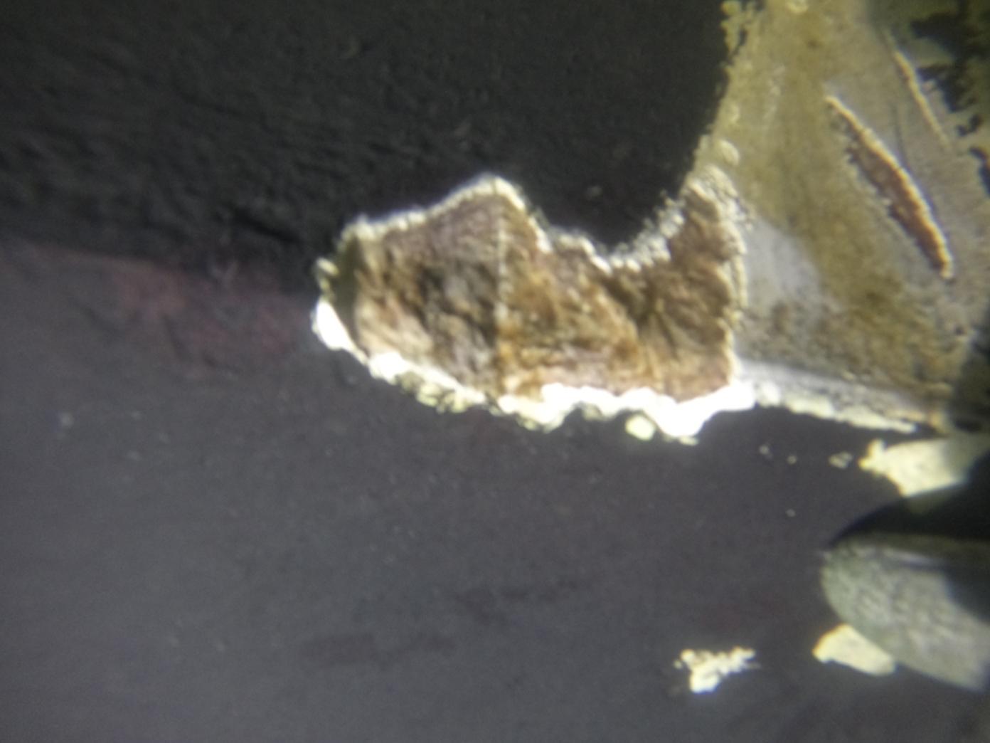
risk of missing this sign:


Miss this sign and you will find yourselves floating over the infamous Chain of Rocks Dam. To. Your.  Doom..   Follow the sign and you will “enjoy” an 8.5 mile no-wake-speed slog down the Chain of Rocks Canal to the Chain of Rocks Lock. 

Beyond the scenic boredom of Chain of Rocks lies  St Louis, a city whose history is largely defined by the river.  But with one prominent exception (The Gateway Arch) it is a city that seems to have turned its back on the river.   There are no boater facilities, no waterfront access or development.  Just barge terminals and flood walls.    

The existence of the cities and towns along the Western Rivers is dominated by flood risk.  So they seem to fall into two categories.   Some are quite distant from the river.  These then require a hike/Uber/Courtesy Car in order to access city amenities.   The few cities built close to the river looked a bit like medieval walled cities, guarded by walls, towers, and levies against the threats from the waters.  A downright inhospitable look to approaching Loopers.


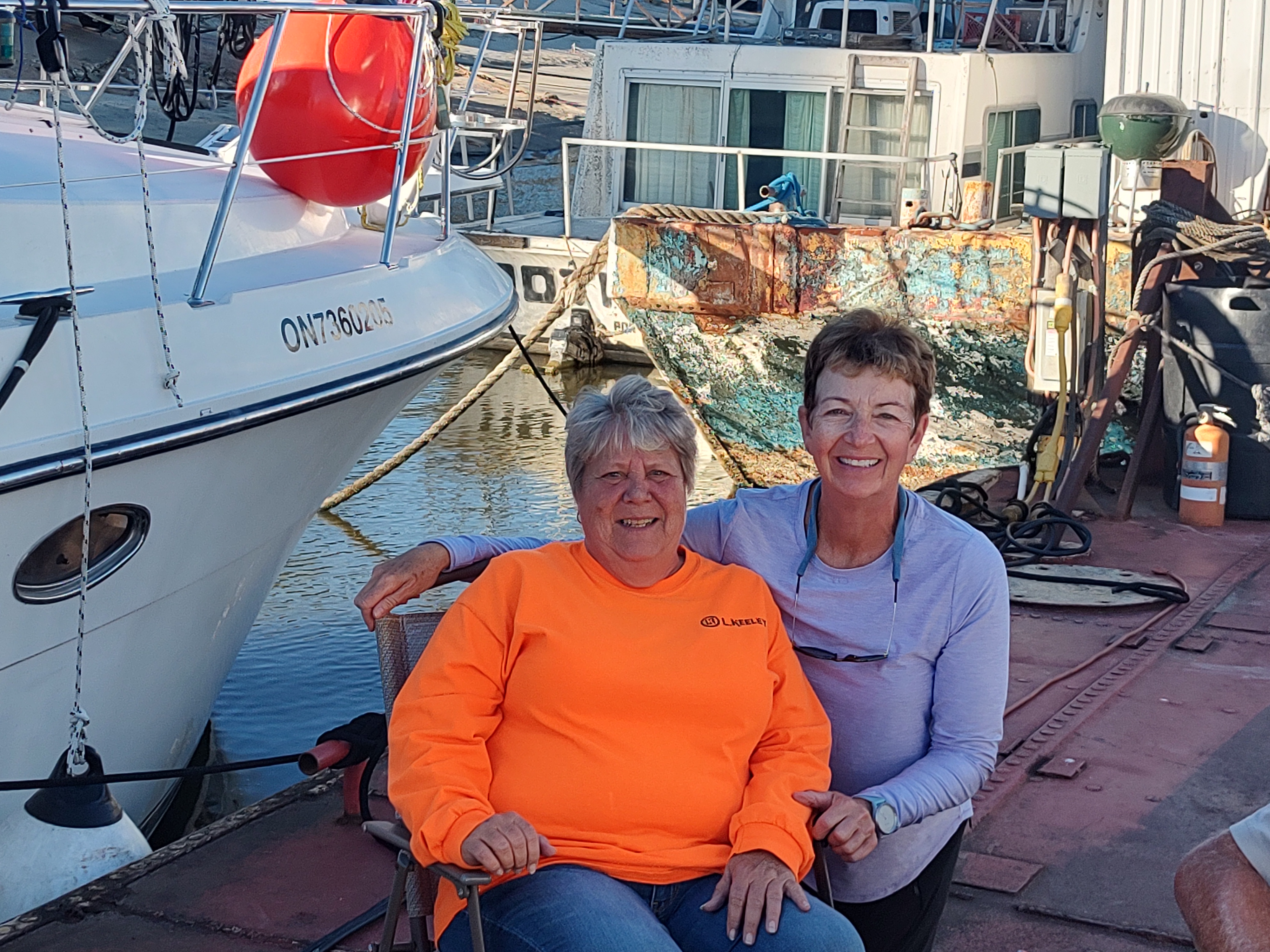
After a cooperative photographic monument in St Louis with buddy boat Water Witch…..


…..we headed downriver to  our port for the night , Hoppies Marine Service.   A legend among Loopers, Hoppies is that only reliable source of fuel between Alton, IL and Paducah, KY, a distance of some 250 miles.   And like some of the places we stopped on the Illinois, Hoppies is (to put it politely) rustic, consisting of three re-purposed river barges moored just off the river channel with a fuel pump and space of 6-8 boats.  The decks are strewn with gear and simply walking the length of “docks” is hazardous.  And we were SO glad to have it available.  


The folks who run the place are wonderfully helpful, especially Debbie, daughter of the founders,  Hoppie and Fern (now in their 90’s), who provided an invaluable briefing on current river and anchorage conditions.   With water levels “on a fall” and no marinas for 200 miles, her knowledge and insights helped us understand which anchorage sites would eb available to us.  We topped off the evening with a short Uber ride for a Looper Italian dinner in the town of Liberty, MO.


Departing Hoppies on a brisk current,
 our group headed for the mouth if the Kaskaskia River 42 miles to the south, where a USACE  dam provides free mooring space (no power or water) along a lock wall for 8-10 boats.  We tied to the concrete wall and dinghied Admiral Maggie to shore for her “business” and for a nice walk to the nearby visitors center.  The young docent there didn’t comment that we were still wearing our life jackets, but asked if we wanted to see the inside of the lock.  We declined, noting that we had seen the inside of more than enough locks, thank you VERY  much.      We closed out the evening with a sunset Docktails (Wall-tails?) gathering atop the lock wall.


October 1 saw on a 70 mile voyage to an anchorage known as Little Diversion Canal.  A man-made channel intended to divert storm water to the river from several Missouri communities, it provides a secure sheltered anchorage (as long as its not raining!) and is another Looper “secret”. With space for 6-10 boats.   At “normal” water levels, it offers a 70’ wide, 20’ deep channel with good anchor holding and wooded shore.  In our current situation, it offered a muddy ditch, barely 50’ wide with maybe 6’ of water at the center.  Add a 3+kt river current  and a prominent sandbar at the entrance and it got  even more challenging.  Still, we managed to get 7 boats secure with bow and stern anchors and settled in for the night.


With the narrow confines, getting Admiral Maggie to shore required only a short dinghy ride.  All we had to do was run the bow of the dinghy up on the shore and hop out on to dry land, right?  Well, not so much.  What she (and we) encountered for the first time was Mississippi Mud.  OMG.  It’s a black mix of fine silt, clay, and god-knows-what-else with adhesive properties like no other.  NASA should be using this stuff to hold the International Space Station together.  SHEESH!   the first trip left the floor of the dinghy smeared with mud and  it took is 20 minutes to clean it from Maggie’s paws and our shoes.  Even Commadore Kathleen’s prized $15 rubber boots were no match for it.  For subsequent trips, we modified our technique to allow Maggie to hop ashore for her needs while we waited in the dinghy.  (he,he he😊 )

With many anchorages below Little Diversion unavailable due to low water,   We and Water Witch decided our next day would be a 100 mile stretch all the way to Paducah, Ky on the Ohio River.    This would be our longest voyage to date in both time and distance and a test our endurance (and that of Maggie’s bladder.) 

Like most folks, you probably think the Mississippi flows south.  But the stretch between Little Diversion and Cairo (“Kay-row”) IL uses the entire compass.  It winds from south to West, to east, to north, and back to south.  Like a drunken snake.  


But we were pleased by the limited barge traffic and were able to cruise at 10.5-11 knots to help reduce our travel time.   Then, just 20 miles above Cairo ("Kay-row"), in some of the twistiest sections of the river, we encountered eight large tows in a row, requiring that we slow down and proceed cautiously along the edge of the charted channel to give them sufficient room.   Turns out there was  a large dredge working just above Cairo that had been holding back traffic and paused its work to allow all these towboats to pass with their attendant barges.   Right in our faces.  Your tax dollars at work.  Sheesh. 

At Cairo (“Kay-row”)  we left the Mississippi and turned to port to begin a short  voyage on the Ohio River.   


Now THIS is a river worthy of the title “Mighty”.   At this point the Ohio is twice as  wide, twice as deep, and twice as clean  as the Mississippi.    In fact, were it not for the Ohio’s contribution, we question whether the Mississippi would even reach the Gulf of Mexico.

With 45 miles still left in our voyage, two other things changed with our turn into the Ohio.  First the current was no longer our friend.  Second, the navigation buoys switch sides of the river.  Because we were now proceeding upstream for the first time since leaving Lake Michigan.   We had to adjust our RPM to maintain our speed and adjust our piloting to get back into a “red right returning” mindset. 

In company with Water Witch and a very intrepid canoeist bound for Knoxville)..... 

.......we passed thru the Olmstead Lock and made our way to the City Transient Dock at Paducah, KY.    A recent addition to the Ohio River, this facility became and instant hit with Loopers, adding a much-needed fuel and rest stop between Hoppies and the resorts in the Kentucky Lakes region.  After 10 hours underway we were a bit weary (and Admiral Maggie was REALLY ready for a trip to store.)   Fortunately, we arrived in the midst of evening Docktails for a dozen  Looper boats and received refreshments and  no shortage of (good and bad) docking advice and assistance. 

Next up?  Kentucky Lakes.  But that is for another time..

Thanks for following.  Be sure to track us on NEBO!